
With Uttarakhand’s tourism department projecting a 14 percent rise in hill-station footfall for the April–June 2026 window, the pressure on Mussoorie’s most-photographed landmarks — Kempty Falls, Gun Hill, and the Company Garden — is already being felt by hoteliers and local transport operators along the Dehradun–Mussoorie highway. Yet roughly 8 kilometres west of the Mall Road crowds, a trail that most visitors never find on a travel aggregator is quietly drawing a different kind of traveller.
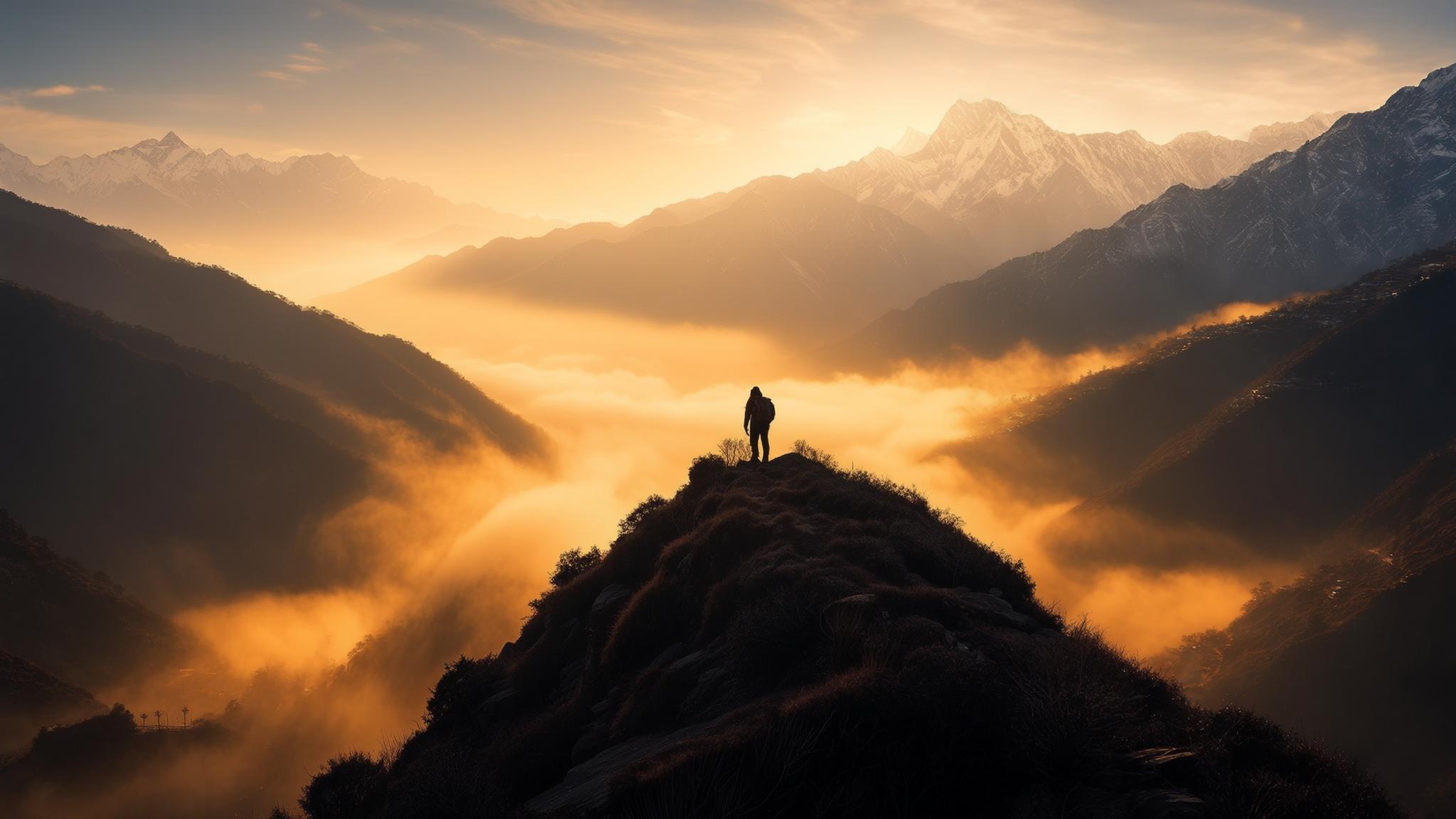
The George Everest Peak trail, a 6km out-and-back route beginning near the Hathipaon ridge, terminates at the ruins and partially restored estate of Sir George Everest — the British surveyor-general after whom the world’s highest mountain was named. The site sits at approximately 2,000 metres above sea level, and on clear spring mornings, it offers sightlines across the Doon Valley to the south and toward the Bandarpunch massif to the northeast.
What Makes the George Everest Trail Different From Other Mussoorie Day Treks
The straightforward answer is gradient and crowd density. The path from Hathipaon to the peak gains roughly 200 metres in elevation over 3km — manageable for most adults who are reasonably active — and on a typical spring weekday, trekkers report passing fewer than 20 other visitors on the entire route. That figure contrasts sharply with Kempty Falls, where the Uttarakhand Tourism Development Board has recorded entry counts exceeding 4,000 visitors per day during April and May holidays.
The trail surface is a mix of compacted earth and loose stone for the first kilometre, transitioning to a narrower ridge path with moderate tree cover. Dense oak and rhododendron canopy keeps the route cooler than the exposed Mall Road by an estimated 3 to 4 degrees Celsius during afternoon hours, according to observations from local guides who operate in the area.
Getting There: Distances, Auto Fares, and the Shared Cab Situation
Hathipaon, the closest motorable point to the trailhead, sits approximately 6km from Library Chowk on the western end of Mussoorie’s Mall Road. The road is narrow in sections and not recommended for large buses. Most visitors reach Hathipaon one of three ways.
- Shared jeep/cab from Library Chowk: ₹30–₹50 per seat on a shared basis, departing roughly every 40 minutes during daylight hours. The journey takes 15 to 20 minutes depending on traffic.
- Private taxi: ₹350–₹500 one way from Library Chowk, negotiated directly with drivers at the stand. Drivers will typically wait for 3–4 hours for a return trip for ₹700–₹900 total.
- On foot from Cloud’s End: Experienced walkers who continue past the Cloud’s End Hotel can join a connecting path to the George Everest trail in approximately 45 minutes, adding roughly 3km each way.
What Local Guides and Guesthouse Owners Are Saying About Spring 2026 Demand
Ramesh Negi, a guide who has operated treks in the Mussoorie western ridge area for over a decade, told NPP Mussoorie that bookings for the George Everest trail have increased noticeably since late February 2026. “Last April I was doing two groups a week. This year I already have six confirmed groups for April alone, mostly from Delhi and Pune,” Negi said in a conversation at his Hathipaon base in mid-March.
Anita Rawat, who manages a six-room guesthouse near the Hathipaon road junction, confirmed that inquiries specifically mentioning the George Everest trail have come from at least four different travel content creators in the past two months. “They come, they film the trail, they post, and then more people call,” Rawat said. She added that her weekday occupancy for April is already at 80 percent, compared to approximately 55 percent at the same point last year.
The Uttarakhand Tourism Development Board, in its March 2026 pre-season advisory published on the official Uttarakhand Tourism portal, listed George Everest Peak among ten recommended heritage trails in the Garhwal foothills — the first time the site has appeared in a formal government-endorsed seasonal advisory.
The Historical Context: Why the Site Matters Beyond the View
Sir George Everest (1790–1866) served as Surveyor General of India from 1830 to 1843 and used the estate at Park Estate — now commonly referred to as the George Everest House — as both a residence and a working base for the Great Trigonometrical Survey of India. The survey ultimately produced the precise measurements that confirmed the height of Peak XV in the Himalayas, which was renamed Mount Everest in his honour in 1865, a year before his death.
The estate’s stone buildings, partially restored by the Archaeological Survey of India, include the main house and an observatory structure. The Archaeological Survey of India classifies the property as a protected monument, and visitors are not permitted inside the main structure, though the surrounding grounds and the ridge viewpoint are fully accessible after paying the entry fee.
What the Spring 2026 Surge Means for the Trail’s Future
The increase in interest raises a familiar tension that conservationists in the Mussoorie region have flagged in other contexts: as a site becomes more widely promoted, the conditions that make it appealing begin to erode. The George Everest trail currently has no formal waste management infrastructure, no permanent toilet facility, and no regulated carrying capacity.
Sanjay Bisht, a Dehradun-based environmental researcher who has studied visitor impact on Garhwal forest trails, said in a March 2026 interview that the site’s current fragility is a genuine concern. “The forest department corridor the trail passes through has decent biodiversity. Lantana is already a problem on the lower section. If we get 500 people a day there without any management framework, the degradation will happen faster than most people expect,” Bisht said.
The Mussoorie Municipal Board did not respond to NPP Mussoorie’s request for comment on whether a trail management plan is under consideration for the western ridge area before the 2026 peak season. The Uttarakhand Forest Department’s Dehradun division confirmed in a brief written response that the trail falls within a protected forest area but said no formal carrying capacity assessment has been commissioned to date.
For now, the George Everest Peak trail remains one of the few places within a day’s walk of Mussoorie’s most crowded thoroughfare where the Himalayan panorama is visible without a cable-car queue or a souvenir stall in the foreground — a condition that, based on the trajectory of visitor interest in spring 2026, may not persist indefinitely.