
On a Saturday morning in late March, a family of four from Dehradun arrived at the Hathipaon trailhead with packed lunches and no map. They had asked their hotel receptionist for a quiet walk. He pointed west, said ‘George Everest,’ and sketched a rough line on a napkin. Two hours later, standing at the edge of a crumbling stone terrace with Bandarpunch and Swargarohini visible to the north, the father told a fellow hiker it was the best ₹0 he had ever spent in Uttarakhand.
That experience is repeatable, documented, and entirely accessible — yet the George Everest Peak trail remains one of the least-crowded day walks available from a hill station that receives roughly 1.5 million visitors annually, according to estimates from the Uttarakhand Tourism Development Board.
Where the Trail Starts and What You Are Walking Toward
The trailhead sits at Hathipaon village, reachable by shared jeep or private taxi from Mussoorie’s Library Bus Stand for approximately ₹150–₹200 per person one-way. Most drivers know the destination by name. The walk itself follows a ridge path through mixed oak and rhododendron forest before opening onto the plateau where Sir George Everest — Surveyor General of India from 1830 to 1843 — built his working residence and laboratory in the 1830s.
The estate, locally called ‘Park Estate,’ is now a protected Archaeological Survey of India (ASI) site. Two stone structures remain: the main house and a smaller laboratory building. Both are roofless and partially collapsed, but the stonework is intact enough to communicate scale. The ASI has placed informational plaques at the site, though visitors report that some panels were damaged as of early 2026.
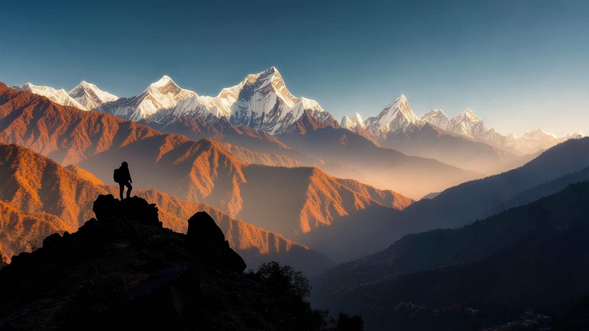
At 2,000 metres above sea level, the peak offers what many trekking communities on platforms like Wikiloc and AllTrails describe as the most accessible 270-degree Himalayan viewpoint from any Mussoorie-adjacent trail. On clear days — most reliably from October through June — the visible peaks include Bandarpunch (6,316 m), Swargarohini (6,252 m), and the Gangotri range.
The History That Gives the Walk Its Weight
Sir George Everest used the Mussoorie estate as a base for the Great Trigonometrical Survey of India, one of the most ambitious mapping projects in colonial history. The survey, which ran across decades in the 19th century, produced the triangulation data that ultimately allowed Andrew Waugh — Everest’s successor — to calculate the height of Peak XV in the Himalayas. Waugh proposed naming the peak after Everest in 1865, a designation the Royal Geographical Society formalised that year.
Everest himself reportedly objected to the honour, noting that local populations had their own names for the mountain — Sagarmatha in Nepali, Chomolungma in Tibetan — and that a name unpronounceable to Indian speakers was a poor choice. This context, documented by historians including John Keay in The Great Arc (HarperCollins, 2000), gives the Mussoorie estate an ironic quality: the man memorialised by the world’s most famous summit was working here, in these now-roofless rooms, doing calculations that would lead to that very naming.
How the Trail Compares to Mussoorie’s More Visited Walks
Mussoorie offers several well-marketed walking routes: the Camel’s Back Road, the Lal Tibba viewpoint, and the Jharipani Falls path. Each draws consistent crowds throughout the tourist season, which peaks between April and June and again in October and November. The George Everest trail, by contrast, sees a fraction of that traffic.
The trail difficulty is rated moderate by trekking communities on Wikiloc, with no technical sections and no requirement for specialised gear. However, the path narrows in two sections and becomes muddy after rainfall, which is relevant during the July–September monsoon window.
Practical Information: Season, Gear, and Getting There
The best window for the George Everest Peak trek runs from October to early June. Winter months (December to February) bring cold temperatures — lows can drop to -2°C at the peak — but also the clearest mountain views, since post-monsoon haze has cleared. The spring window of March to May offers warmer conditions and rhododendron blooms along the lower trail sections.
What to carry on the day:
- At least 1.5 litres of water — no vendors operate along the trail
- Snacks or a packed lunch; the nearest dhabas are back at Hathipaon village
- Trekking shoes or sturdy sneakers; sandals are not appropriate for the narrowing ridge sections
- A light windproof layer even in summer — the exposed plateau at the peak is significantly cooler than Mall Road
- Sun protection; the upper trail has limited tree cover
Taxis from Mussoorie’s Library Stand to Hathipaon charge approximately ₹300–₹400 for a private cab or ₹150–₹200 per seat in a shared jeep. Return taxis can be arranged by asking drivers to wait (typical waiting charge: ₹100–₹150 per hour) or by calling back through the hotel. Mobile signal on the trail is intermittent but generally available at the peak itself, where BSNL and Jio networks register a usable signal in fair weather.
What Comes Next for the Site
The Archaeological Survey of India listed the George Everest estate as a protected monument, but local historians and trekking advocates have for several years called for better signage, a maintained approach path, and a small interpretive centre. As of April 2026, no construction or development work has been formally announced at the site by ASI or the Uttarakhand state government.
The Uttarakhand Tourism Development Board includes George Everest Peak in its official list of Mussoorie attractions but does not currently operate a dedicated shuttle or guided tour to the site. Independent guides offering the trek can be arranged through hotels in Mussoorie for approximately ₹500–₹800 per group, according to rates quoted by three Mussoorie-based operators contacted by NPP Mussoorie in March 2026.
For visitors planning a Mussoorie trip around the April–May 2026 window — which encompasses the school holiday peak season — booking accommodation three to four weeks in advance is advisable, as mid-range hotels in the ₹1,500–₹3,500 per night range fill quickly. The George Everest trail itself requires no booking and no permit, making it one of the few genuinely walk-up experiences remaining near a major Uttarakhand hill station.