
What would you do differently on your next hill-station trip if you knew that the most dramatic view in Mussoorie was not on any printed tourist map? That question has a concrete answer for the thousands of visitors who arrive each year at this Uttarakhand hill station — and most of them leave without ever knowing it.
Mussoorie, situated at approximately 2,005 metres above sea level in the Garhwal Himalayas, draws an estimated 1.5 million domestic and international tourists annually, according to the Uttarakhand Tourism Development Board. The majority concentrate on the 2.5-kilometre Mall Road strip, the ropeway to Gun Hill, and the Kempty Falls road. A ridge trail running northeast of Lal Tibba — Mussoorie’s highest point at 2,275 metres — remains largely untrafficked by out-of-town visitors.
Where the Trail Begins and What the Route Looks Like
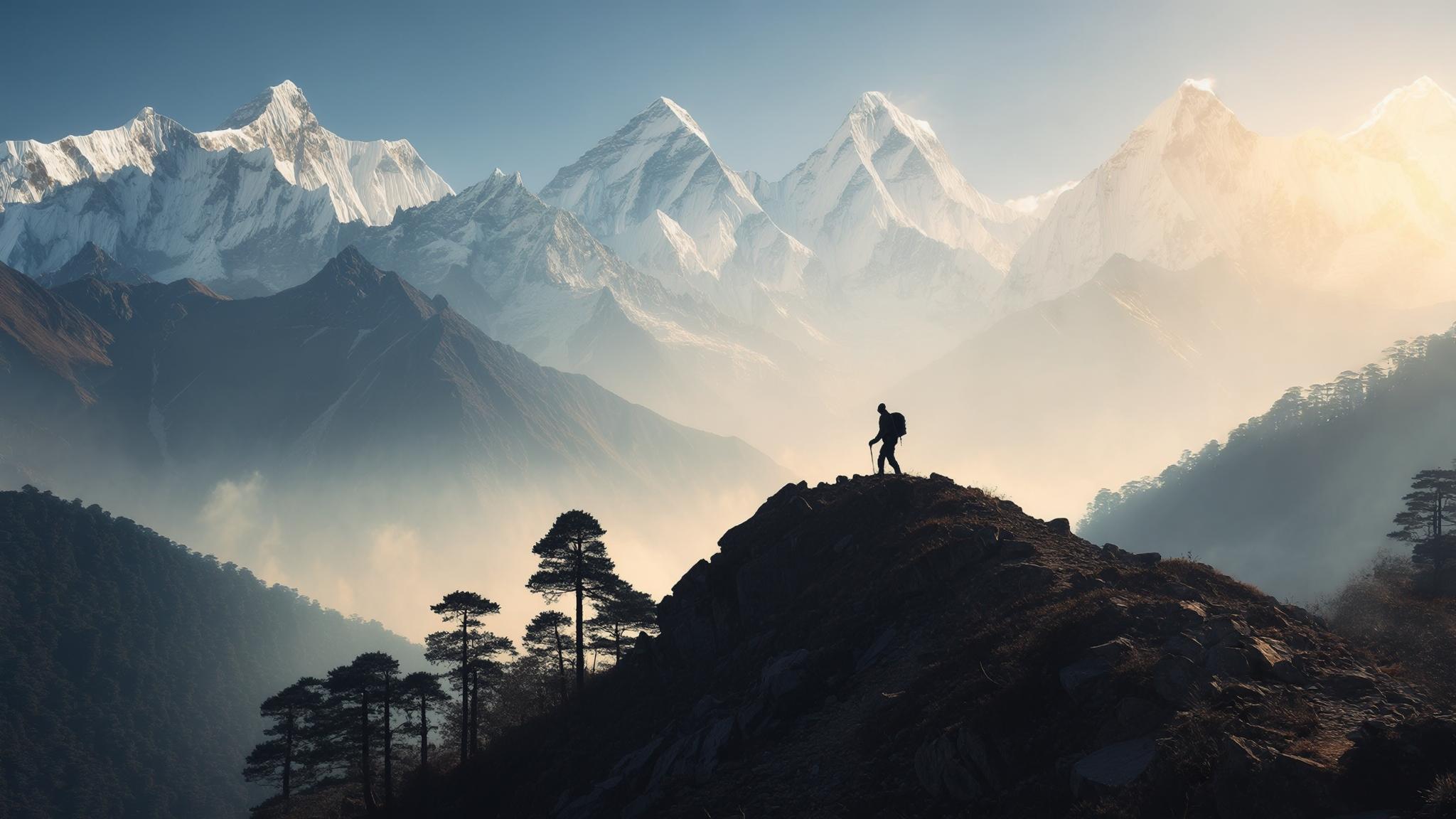
The trail starts at the Lal Tibba viewpoint in the Landour cantonment area, roughly 5 kilometres from the Library Chowk end of Mall Road. From Lal Tibba, a dirt track continues northeast past the Landour Language School and the old British-era cottages that line the upper ridge. The route is not marked with signage; most visitors who find it do so by asking at Char Dukan, the cluster of four tea shops at the Landour intersection that has operated in various forms since the 19th century.
The trail passes through mixed oak and rhododendron forest for the first two kilometres before opening onto a cleared ridge section where the panoramic view becomes fully visible. Local guide Ramesh Negi, who has led treks in the Mussoorie-Landour area for approximately 14 years, described the experience to NPP Mussoorie.
The trail’s total one-way distance is approximately 6 kilometres from Lal Tibba, with a return journey of the same distance. Most trekkers of moderate fitness complete the round trip in four to five hours, including rest stops. The final kilometre involves a steeper descent to a seasonal stream crossing before the ridge levels again at the far viewpoint.
Costs, Permits, and Practical Logistics
Accessing the trail costs very little by design. There is no entry fee for the Landour cantonment walking paths, and no trekking permit is required for the standard ridge route as of March 2026, according to the Landour Cantonment Board office. Visitors arriving by shared jeep from Library Chowk to Lal Tibba pay approximately ₹30–₹50 per seat; a private taxi from Mall Road to Lal Tibba typically costs ₹300–₹500 depending on negotiation.
Hiring a local guide is optional but recommended for first-time visitors. The Char Dukan area has an informal network of guides who can be approached directly; rates are negotiable and typically range from ₹800 to ₹1,200 for a half-day outing. Negi cautioned that independent walkers should carry their own water, as there are no shops along the ridge route beyond Char Dukan.
Accommodation in the Landour area tends to be quieter and less expensive than Mall Road properties. Guesthouses near the Landour clock tower charge approximately ₹1,200–₹2,500 per night for a standard double room, compared to ₹3,000–₹8,000 or more for equivalent rooms on or near Mall Road, according to listings reviewed on MakeMyTrip in March 2026.
Best Seasons and Weather Considerations
The trail is accessible in three of the four seasons, with each period offering a distinct experience. Winter months — November through February — produce the clearest mountain views because low humidity reduces atmospheric haze. Temperatures at the ridge can drop to -5°C or below on winter nights, and snow occasionally covers the upper sections from December onward, making traction footwear essential.
The monsoon season — June through September — is the one period when the trail is actively discouraged by local guides. Rainfall in Mussoorie averages approximately 2,000 millimetres annually, with the bulk falling between July and August, according to data published by the India Meteorological Department. Wet conditions make the clay-heavy sections of the ridge trail slippery, and the mountain views are almost entirely obscured by cloud cover during this period.
What Local Businesses and Residents Say About the Trail’s Future
The relative obscurity of the ridge trail is not accidental, and some in the Landour community prefer it that way. Priya Mehta, who runs a small guesthouse near the Landour clock tower and has lived in the area for over a decade, told NPP Mussoorie that the trail’s low profile has helped preserve the experience.
Kempty Falls, located approximately 15 kilometres from Mussoorie town, receives an estimated 3,000–5,000 visitors on peak weekend days during the April–June tourist season, according to figures cited by the Uttarakhand Tourism Department. The contrast with the ridge trail — which sees perhaps a few dozen walkers on the same days — is significant.
The Uttarakhand government’s 2025–2026 tourism development plan, referenced in documents published by Uttarakhand Tourism, includes provisions for developing trekking infrastructure in the Mussoorie-Landour belt, including waymarking and basic trail maintenance. Whether that investment will extend to the Lal Tibba ridge route — and what effect increased visibility might have on the trail’s character — remains an open question among local stakeholders.
For travelers who have already visited Mussoorie’s standard circuit, the ridge trail represents a genuinely different register of experience — physically demanding enough to feel earned, but accessible without specialist equipment or advance permits. Whether the Uttarakhand government’s infrastructure plans ultimately bring more visitors to the route, or whether it remains the quiet preserve of early-rising walkers and local guides, the trail’s geography is not going anywhere. The Himalayan peaks it frames have been visible from this ridge for longer than Mussoorie itself has existed.