
On a clear March morning, a retired schoolteacher from Dehradun laces up his boots at the Lal Tibba parking area, nods to the chai vendor who has known him for fifteen years, and disappears into the deodar forest above Mussoorie’s western ridge. Two hours later, he is sitting on a flat boulder with a direct sightline to Bandarpunch and Swargarohini — and not another tourist in sight.
That experience, according to local trekking guides and longtime Mussoorie residents, is increasingly rare on the hill station’s more famous routes. The trail system running through the Landour and Childer’s Lodge forest reserve, however, has remained comparatively uncrowded — partly because it lacks signage, partly because it requires a modest fitness level, and partly because no tour operator has yet packaged it aggressively.
Where the Trail Begins and How to Reach It
The primary access point is the Lal Tibba area in Landour, approximately 5 kilometres from Mussoorie’s Library Chowk by road. From Library Chowk, shared jeeps run to Landour Chowk for roughly ₹30 to ₹50 per seat, according to local transport operators. From Landour Chowk, the trail head near the old Childer’s Lodge ruins is a 15-minute walk uphill along a paved lane.
A secondary entry point exists near Sisters Bazaar, the small market serving the Landour Language School community. This entry is less steep and better suited to hikers who are not acclimatised to the altitude, which sits between 2,100 and 2,275 metres above sea level across the trail’s length.
The Uttarakhand Forest Department maintains the deodar and oak stands through which the trail passes, but as of March 2026, no formal permit or registration is required for day hikers. Overnight camping within the reserve requires prior permission from the Divisional Forest Officer’s office in Dehradun, according to the department’s publicly available guidelines.
What Hikers Actually See — and When Visibility Is Best
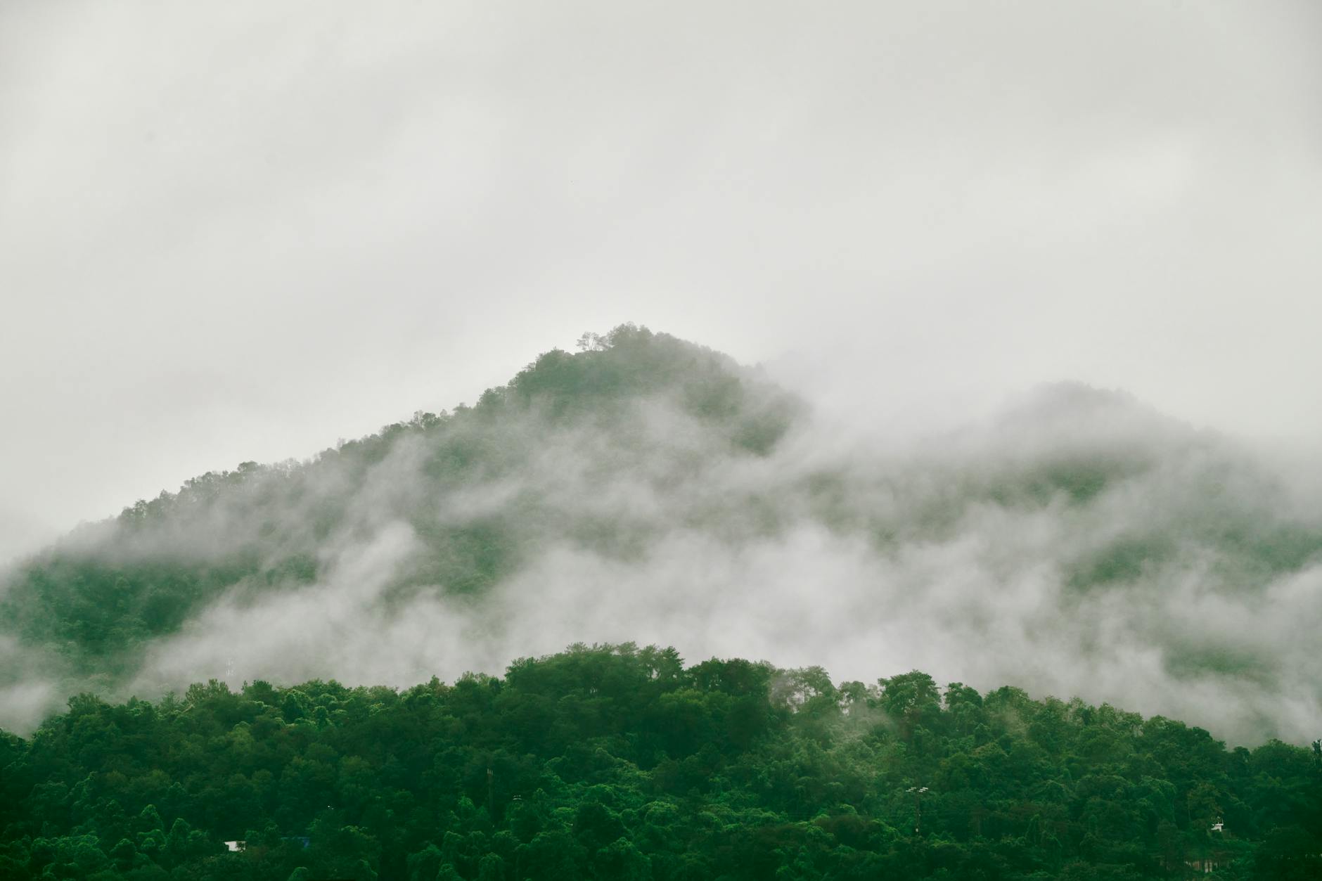
The trail’s primary draw is the unobstructed northern view from the upper ridge section, which faces directly toward the Garhwal Himalayan range. On clear days, hikers can identify Bandarpunch (6,316 metres), Swargarohini (6,252 metres), and the Gangotri group of peaks without optical aids, according to guides affiliated with Mussoorie-based trekking operators.
Visibility is most reliable between October and early December, when post-monsoon clarity is at its highest and snow has not yet accumulated on the approach paths. The March-to-May window, currently underway, also offers good visibility, though afternoon haze can reduce sightlines by early afternoon. The monsoon months of July and August bring leeches to the forest floor and significantly reduce visibility, though the forest itself is dramatically green during this period.
Realistic Costs for a Day Hike From Mussoorie Town
The trail itself is free, but a realistic day-trip budget from Mussoorie’s central areas should account for transport, food, and optional guide fees. The following breakdown is based on rates current as of March 2026, sourced from local operators and transport providers.
Guides can be arranged through several operators on Mall Road and in Landour Chowk. First-time visitors unfamiliar with the forest’s branching paths are advised to hire a local guide, as the trail lacks consistent waymarking and wrong turns can add significant distance and time to the hike.
The Landour Context: Why This Area Remains Different From Mussoorie Proper
Landour is a cantonment area administered separately from Mussoorie Municipal Board, a distinction that has historically limited commercial development and preserved much of its forest cover and colonial-era architecture. The Uttarakhand government classifies portions of the surrounding forest as a protected reserve, which further restricts construction within the trail’s immediate catchment area.
The area is also associated with author Ruskin Bond, who has lived in Landour for decades and has written extensively about its forests and seasonal character. His descriptions of the deodar canopy and mountain views in works published over several decades have drawn a steady stream of literary tourists to the neighbourhood, though most do not venture beyond the famous Char Dukan tea stalls.
Planning Your Visit: A Practical Checklist
Based on information gathered from local guides, the Uttarakhand Tourism Department’s published materials, and firsthand accounts from recent visitors, the following preparation steps apply to most day hikers attempting the ridge trail in 2026.
The Uttarakhand Tourism Development Board lists Mussoorie among its priority hill station destinations for 2026, with ongoing infrastructure investment focused primarily on the Kempty Falls corridor and the Dehradun-Mussoorie road. The Landour trail system does not currently appear in the board’s promotional materials, which local guides say has contributed to its uncrowded character.
Whether that changes as Mussoorie’s overall visitor numbers continue to grow — the hill station received an estimated 35 lakh visitors annually in recent pre-pandemic years, according to state tourism data — remains to be seen. For now, the forest above Landour remains what it has been for decades: accessible, free, and largely unannounced.