
What does it mean to visit a hill station if every viewpoint is shared with a hundred strangers? That question sits at the centre of what makes Cloud’s End, a largely overlooked stretch at the western tip of Mussoorie, worth the detour — and worth writing about in March 2026, as the pre-summer tourist season begins to swell again.
Cloud’s End sits approximately 6 kilometres from the Library Bus Stand in Mussoorie, Uttarakhand, at an elevation of roughly 2,000 metres above sea level. It marks the formal boundary where the town ends and Benog Wildlife Sanctuary begins. Unlike Kempty Falls or Gun Hill, this area draws no organised bus routes and no dedicated cable car. Visitors who reach it do so by private taxi, shared jeep, or on foot.
What Cloud’s End Actually Offers — and What It Does Not
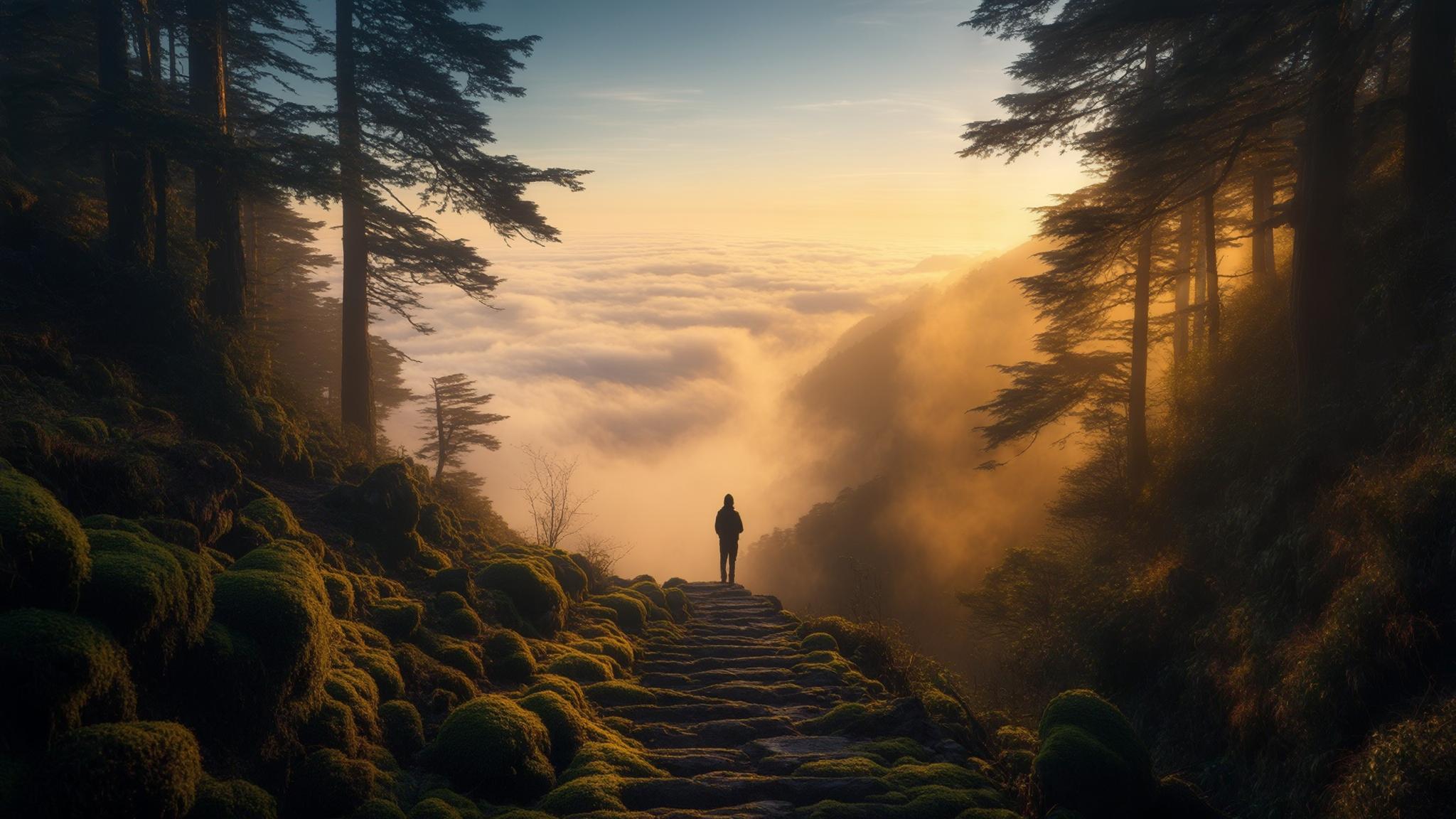
Cloud’s End delivers two things reliably: a dense oak and rhododendron forest canopy, and a wide, unobstructed view of the Doon Valley below. On clear mornings in late March, the valley is visible from approximately 30 kilometres out, according to regular visitors who document the spot on hiking forums. The forest trail into Benog Wildlife Sanctuary begins just past the Heritage Hotel at Cloud’s End, a property housed in a British-era structure that dates back over a century.
What Cloud’s End does not offer is infrastructure. There are no roadside stalls selling Maggi past the hotel, no photo booths, no ticketed viewpoints. The Benog Sanctuary trail requires a forest department entry permit, which costs ₹50 per person for domestic tourists and ₹200 for foreign nationals as of the current rate schedule maintained by the Uttarakhand Forest Department.
The Benog Hill Trek: What the Route Looks Like
The trail from Cloud’s End to Benog Hill is approximately 2 kilometres one way, rising steadily through mixed forest. The surface is unpaved and uneven in sections, making it unsuitable for visitors with limited mobility. Most fit walkers complete the return trip in under two hours, according to accounts compiled by trekking communities active on Himalayan trail networks.
The summit of Benog Hill stands at roughly 2,240 metres and offers views across the Shivalik range on clear days. Birdwatchers have recorded sightings of the Himalayan whistling thrush, white-capped redstart, and lammergeier in the sanctuary — a draw for wildlife enthusiasts that remains underreported in mainstream travel coverage of Mussoorie.
- Trail start: Heritage Hotel, Cloud’s End (6 km from Library Bus Stand)
- Trail length: approximately 2 km one way
- Elevation gain: roughly 240 metres
- Estimated return time: 90 minutes to 2 hours at moderate pace
- Best season: March to June, and September to November
- Forest permit: required, available at the sanctuary gate
George Everest’s Estate: The Historical Anchor
Roughly 6 kilometres from Mall Road — en route to Cloud’s End — sits the estate of Sir George Everest, the British Surveyor General of India whose trigonometrical surveys in the 19th century formed the basis for mapping the Himalayan range. The mountain now named after him was identified during surveys he oversaw. His estate, now maintained in partial restoration, is accessible via a short walk from the road and offers views down both sides of the ridge.
The Archaeological Survey of India (ASI) lists the George Everest Estate as a protected monument. Entry is free, and the site is open from sunrise to sunset on most days. The two-structure property — a residence and a laboratory — sits at the edge of a ridge that drops sharply into the Aglar River valley on one side and the Doon Valley on the other.
Planning a Half-Day Trip: Practical Costs and Timing
A half-day itinerary combining the George Everest Estate and Cloud’s End is achievable from Mussoorie’s town centre in approximately four to five hours. The most practical route runs west along the Camel’s Back Road toward Park Estate, then continues to the Everest Estate stop, and concludes at Cloud’s End for the sanctuary trail.
Morning departures between 7:00 a.m. and 8:00 a.m. are strongly recommended. March mornings in Mussoorie are clear more frequently than afternoons, when valley mist tends to rise and reduce visibility at both viewpoints. The Heritage Hotel at Cloud’s End serves basic meals but does not take walk-in reservations for dining with certainty — carrying packed provisions is advisable.
Cloud’s End is not a dramatic destination by the standards of high-altitude Himalayan travel. It does not require gear, acclimatisation, or advance permits beyond the basic sanctuary fee. What it offers is proportional to how much of Mussoorie’s crowded core a visitor is willing to leave behind — and that, for many travellers arriving in the pre-summer rush of late March and April 2026, may be reason enough to go.