
On a Saturday in late May, Kempty Falls — Mussoorie’s most-visited natural attraction — receives an estimated 4,000 to 5,000 visitors, according to figures cited by Uttarakhand Tourism officers posted at the site. On the same day, the Jharipani waterfall trail, located approximately 8 kilometres east along the ridge, sees fewer than 60 walkers. The gap is not explained by difficulty or distance. It is almost entirely explained by signage — or the absence of it.
The Jharipani route has existed as a walking track for decades, used primarily by residents of the Jharipani village cluster and the staff of a handful of heritage hotels that sit along the upper road. What it has never had is a prominent place on the standard Mussoorie tourist map. That oversight, travel writers and local trek operators say, has kept the trail in the condition most trekkers actually want to find.
Where Jharipani Sits and How to Get There
Jharipani is a small settlement on the eastern edge of the Mussoorie ridge, reachable via a shared auto or taxi from Library Bus Stand in roughly 20 to 25 minutes. Shared autos run the route for approximately ₹30 to ₹50 per seat; a private taxi will typically quote ₹350 to ₹450 for the one-way journey depending on negotiation and season.
The trailhead is generally considered to begin near the Jharipani Forest Rest House, a Uttarakhand Forest Department property that marks the edge of the reserved forest zone. From the rest house, the descent toward the waterfall takes between 45 minutes and one hour at a moderate walking pace, covering approximately 3 kilometres of unpaved trail through mixed oak and rhododendron forest.
The trail is not marked with official signage as of April 2026, which means first-time visitors are strongly advised to ask at the Forest Rest House gate before proceeding. Staff there are generally willing to give basic directional guidance, and entry into the forest zone is free for day walkers — no permit is currently required for individual trekkers on this route, according to local operators who regularly lead groups along the path.
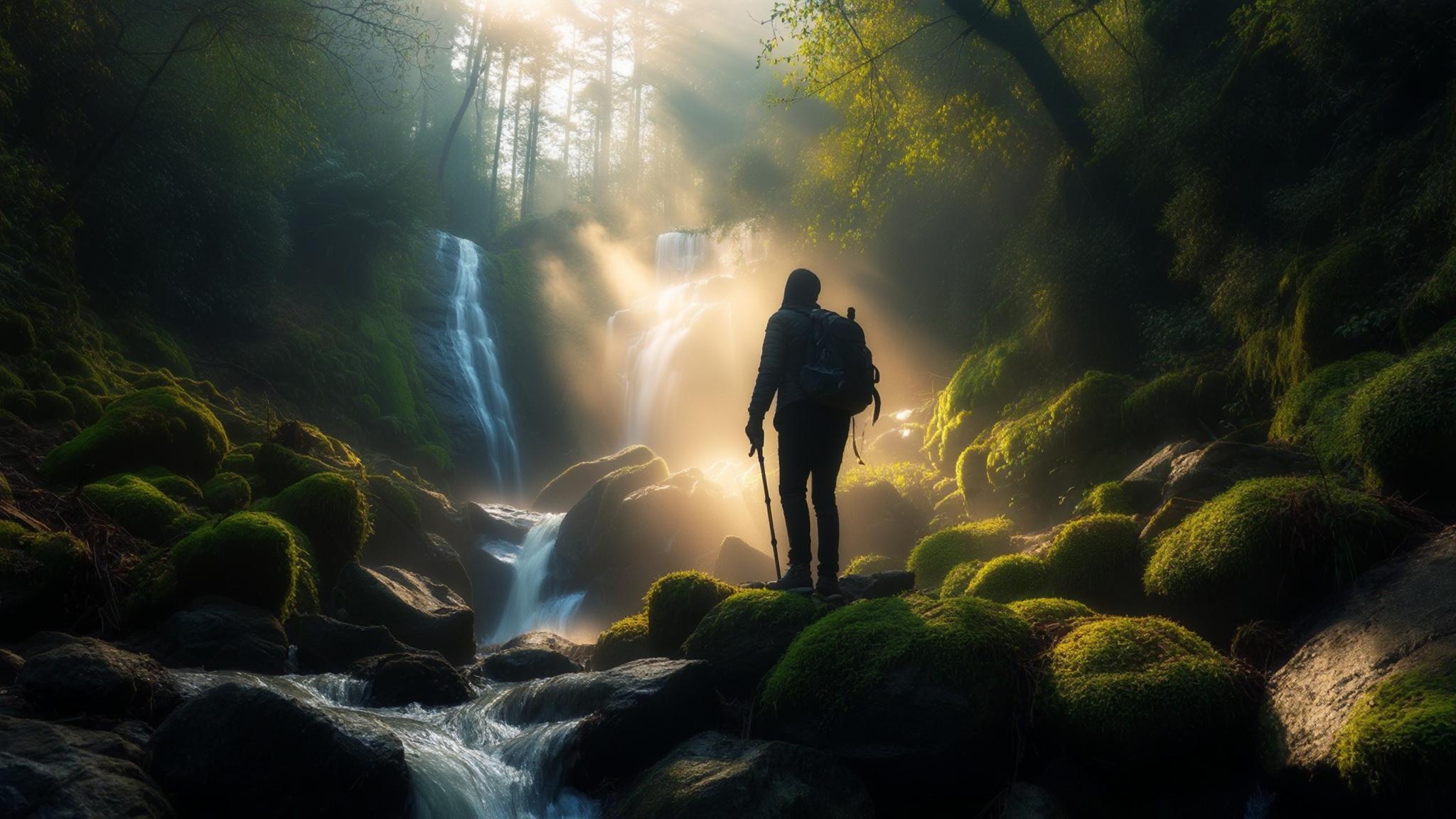
The Trail Itself: Terrain, Flora, and What to Expect
The Jharipani trail descends rather than climbs for most of its length, which makes the outward journey deceptively easy. Trekkers should plan for a harder return leg, particularly during summer months when midday temperatures on the exposed upper section can climb to 28–30°C. The lower sections of the trail, closer to the waterfall, remain significantly cooler due to dense canopy cover.
The forest along the route falls within the Benog Wildlife Sanctuary buffer zone, and walkers frequently report sightings of Himalayan langurs, barking deer, and a wide variety of bird species including the Himalayan bulbul and various flycatchers. The Uttarakhand Forest Department classifies this zone as a moderately biodiverse mixed temperate forest.
The waterfall itself drops approximately 20 to 25 metres over a rock face into a shallow pool. Flow is strongest between July and early October, fed by monsoon runoff from the upper ridge. By December, the fall reduces to a trickle, and from January through March it may partially freeze at higher elevations. Most local guides advise visiting between late August and mid-October for the best combination of water volume and clear skies.
How Jharipani Compares to Kempty Falls
The comparison between Jharipani and Kempty Falls is not really about which is more scenic — that is subjective. The practical differences are significant enough to inform a real travel decision.
Kempty Falls is a legitimate and heavily developed tourist attraction with infrastructure to handle large crowds. Jharipani is the opposite — undeveloped, unsigned, and entirely dependent on the visitor’s own preparation. Neither is inherently better. They serve different purposes and different types of travellers.
Planning a Day Trip: Costs, Timing, and What to Carry
A practical day trip to Jharipani from central Mussoorie can be planned around the following cost breakdown, based on rates current as of early 2026.
Total estimated spend for a solo traveller using shared transport and self-packed food: ₹350 to ₹500. For a couple using a private taxi both ways with a lunch stop in Jharipani village: approximately ₹900 to ₹1,200. These figures are based on current market rates and do not account for guide fees, which local operators charge at approximately ₹800 to ₹1,200 per group for a half-day engagement.
What the Trail’s Low Profile Means for Its Future
Several Mussoorie-based trek operators have noted a gradual increase in queries about the Jharipani route over the past two to three years, attributed partly to social media posts and partly to a broader shift among Indian domestic travellers toward quieter, less commercially developed outdoor experiences. According to Uttarakhand Tourism, domestic nature-based tourism in the state has grown significantly since 2022, with forest trails and offbeat routes seeing increased footfall across multiple districts.
The Uttarakhand Forest Department had not announced any formal management or visitor regulation plan for the Jharipani trail as of the date of publication. NPP Mussoorie reached out to the Mussoorie Range Forest Office for comment and had not received a response by press time.
For now, the trail remains what it has always been: a functional, forest-department-managed walking route used mostly by people who already live near it. Whether that changes in the next two tourist seasons will depend, in part, on how much attention it continues to receive — and whether that attention comes with any accompanying obligation to protect what makes it worth visiting in the first place.
.pvv-faq-section details summary::-webkit-details-marker{display:none}.pvv-faq-section details summary::marker{display:none;content:””}.pvv-faq-section details[open] summary .pvv-faq-arrow{transform:rotate(90deg)}