
The conventional Mussoorie itinerary — Cable Car, Kempty Falls, Mall Road, repeat — has produced a specific kind of traveller disappointment for decades. Overcrowded viewpoints, commercialised waterfalls, and traffic jams on the Dehradun road are now considered standard features of the trip rather than bugs. What the standard itinerary quietly omits is a 6-kilometre trail at the western edge of town that forest department staff, birding groups, and a small circuit of repeat visitors have been using for years without much fanfare.
The Cloud’s End–Benog Hill route, accessible from the old British-era Cloud’s End estate near Baarlaam village, sits inside a protected mixed-oak and rhododendron forest managed by the Uttarakhand Forest Department. Entry is ticketed, wildlife is documented, and the infrastructure — while minimal — is functional. The trail’s anonymity is not accidental; it has simply never been marketed the way Kempty Falls has.
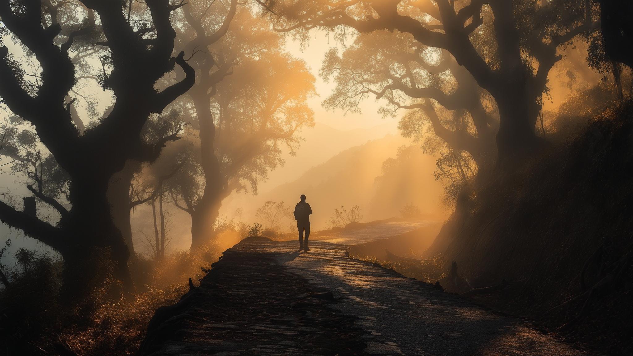
What the Cloud’s End–Benog Hill Trail Actually Offers
The trail delivers what Mussoorie’s marketing promises but its popular sites rarely provide: unobstructed sightlines toward the Aglar Valley, documented sightings of the White-capped Water Redstart and Kalij Pheasant, and, on clear mornings between October and March, a visible Himalayan ridgeline that includes Bandarpunch at approximately 6,316 metres. These are verifiable observations logged by the Birding Uttarakhand community and cross-referenced by forest department records.
The full Cloud’s End–Benog Hill loop covers approximately 5 to 6 kilometres depending on the route taken. Elevation gain from the Cloud’s End gate to Benog Hill summit is roughly 200 metres. Average completion time for a moderate-pace adult is 2.5 to 3.5 hours.
- Forest department entry point: near Cloud’s End Hotel, Baarlaam, approximately 6 km from Library Chowk via the Camel’s Back Road
- Entry ticket: ₹50 per person (Indian nationals) as of early 2026
- Camera fee: ₹25 additional for DSLRs
- Open hours: 6:00 AM to 5:00 PM daily, subject to weather and forest department discretion
- Best season: October to June; trail can be slippery and partially restricted July–September
How It Compares to Kempty Falls on Practical Grounds
Kempty Falls, located about 15 km from Mussoorie on the Chakrata Road, processes visitor volumes that the surrounding road infrastructure was never designed to handle. On weekends between May and June, queues for parking alone routinely exceed 45 minutes according to accounts collected by multiple Mussoorie-based travel operators. The falls themselves are visible from a cemented platform; there is no trail element, no elevation change, and no wildlife component.
What Local Guides and Forest Staff Say
Rajendra Singh, a licensed nature guide registered with the Mussoorie Tourism Development Council, has led groups to Benog Hill for over eleven years. He notes that visitor numbers to the trail have remained consistently low compared to Mussoorie’s overall tourist footfall — something he attributes to the absence of roadside signage and the trail’s omission from most packaged tour itineraries.
A forest department staffer at the Cloud’s End checkpoint, who spoke on background and declined to be named citing departmental protocol, confirmed that daily visitor counts on regular weekdays average between 30 and 80 individuals — a fraction of the thousands who visit Kempty Falls on comparable days.
Getting There and Planning the Visit
Reaching Cloud’s End from the Mall Road requires either a private vehicle or a shared taxi running the Camel’s Back Road route. Shared taxis from Library Chowk charge approximately ₹20–₹30 per seat to the Baarlaam area. Private cabs quote ₹300–₹500 for the return journey with a 2-hour waiting period, based on rates collected from drivers at the Mussoorie taxi stand in March 2026.
The trail is not recommended for visitors with significant mobility limitations. The path surface is natural forest floor — compacted earth, leaf cover, and occasional loose stone. Footwear with grip is advised. The forest department does not provide rental equipment on-site.
The Broader Pattern: What Mussoorie’s Tourism Infrastructure Misses
The Cloud’s End situation is not an isolated case. According to the Uttarakhand Tourism Development Board, the state has catalogued over 400 trekking and nature trail segments across Garhwal, yet fewer than 60 are actively promoted through state tourism channels. The gap between documented natural assets and visitor awareness is a recurring issue that state policy documents have acknowledged without resolving.
Tourism operators in Mussoorie, speaking to NPP Mussoorie in March and April 2026, noted that the incentive structure of the industry directs visitors toward high-volume sites where parking vendors, food stalls, and souvenir shops generate commission income for guides and taxi drivers. A trail that charges ₹50 and has no adjacent commercial activity produces no referral income, so it rarely gets mentioned.
Rajendra Singh frames the dynamic plainly: guides and drivers who recommend Cloud’s End earn nothing beyond their base trip fare. The economic logic of Mussoorie’s tourism chain consistently routes visitors toward sites where ancillary spending is highest — regardless of whether those sites deliver the experience visitors say they are seeking.
For travellers willing to navigate outside that chain, the Cloud’s End–Benog Hill trail remains one of the most accessible forest walks within municipal Mussoorie boundaries — closer to Mall Road than Kempty Falls, cheaper than the cable car, and operating with significantly lower crowd density on any given day of the week.