
Approximately 35 to 40 lakh tourists visit Mussoorie each year, according to estimates from the Uttarakhand Tourism Development Board — yet the overwhelming majority of those visitors spend their time within a two-kilometre stretch of Mall Road, Kempty Falls, and Gun Hill. Eight kilometres to the west, a 239-hectare wildlife sanctuary receives a comparatively negligible share of that footfall. That sanctuary is Benog, and the trail that runs through it to Cloud’s End is among the most accessible wilderness walks in the Garhwal Himalaya.
The sanctuary is classified as a protected area under the Wildlife Protection Act, 1972, and falls under the administrative jurisdiction of the Uttarakhand Forest Department. The forest type is predominantly temperate oak and rhododendron, transitioning to mixed broadleaf cover as elevation drops toward the Aglar river valley below. Recorded species include the barking deer, leopard, yellow-throated marten, Himalayan goral, and a documented avifauna list exceeding 150 bird species, according to forest department records maintained at the Mussoorie range office.
How to Reach Benog From Mussoorie’s Mall Road
The trailhead begins near the Benog hilltop, accessible by road from Library Point — the western end of Mall Road. A shared taxi from Library Point to the Benog hilltop covers approximately 7 km and typically costs ₹300 to ₹500 for the vehicle, depending on negotiation and season. Private cabs quoted at the Library taxi stand in March 2026 ranged from ₹400 to ₹600 for a one-way drop.
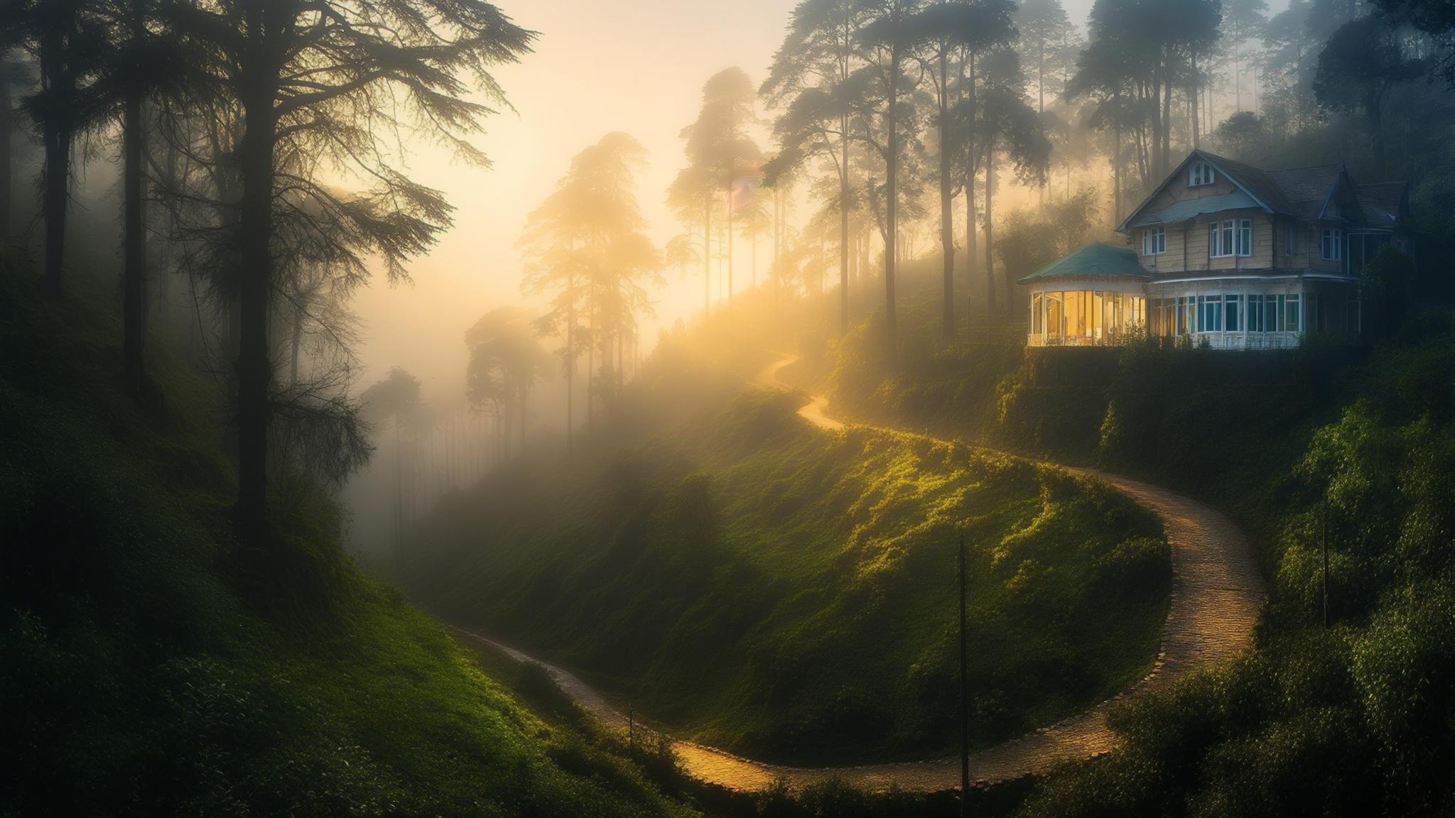
The Benog hilltop itself sits at an elevation of approximately 2,240 metres above sea level. From there, the trail descends westward through the sanctuary toward Cloud’s End — a forested ridge that marks the boundary of the original Mussoorie cantonment land. The historic Cloud’s End Forest Lodge, operated by a private heritage hospitality group, marks the approximate turnaround point for day trekkers.
Trekkers who prefer to walk the full distance from Mall Road can do so via the Camel’s Back Road, adding roughly 4 km to the approach. This route passes through the old cantonment area of Landour and takes walkers along a ridge with views of both the Doon Valley to the south and the higher Himalayan peaks to the north on clear days. The full walking circuit — from Library Point, through Benog sanctuary, to Cloud’s End, and return — covers approximately 14 to 16 km depending on the exact path taken.
What the Forest Department Says About Visitor Access
Access to the sanctuary is managed by the Uttarakhand Forest Department’s Mussoorie forest range. Entry requires a permit obtained at the range office or, in some cases, at the forest checkpost near the Benog hilltop. Forest department guidelines, as published on the Uttarakhand government’s official portal, require visitors to avoid feeding wildlife, stay on marked trails, and exit the sanctuary before sunset.
According to the Uttarakhand Forest Department, Benog is one of several small protected areas within the Garhwal division that functions as a biodiversity corridor connecting larger forest blocks to the north. Forest officials at the Mussoorie range have noted in departmental communications that visitor numbers to Benog remain far below the sanctuary’s carrying capacity, which they estimate at several hundred visitors per day.
Best Season to Visit and What to Expect on the Trail
The sanctuary is accessible year-round, but conditions vary significantly by season. March through June offers the most rewarding experience for most visitors — rhododendron trees bloom in scarlet and pink from late February through April, temperatures at the hilltop remain between 8°C and 18°C, and visibility on clear mornings allows views of snow-covered peaks including Bandarpunch and Swargarohini in the Uttarkashi district.
The monsoon months of July through September bring heavy precipitation that makes the trail slippery and significantly increases leech activity. The Forest Department does not formally close the sanctuary during monsoon but advises caution. October and November are dry, clear, and cool — considered by birding communities to be the optimal window for avifauna observation, as migratory species pass through the Doon Valley corridor below.
Winter visitors — December through February — face the coldest conditions but also the fewest crowds. Snow occasionally covers the trail from January onward, and the Benog hilltop on a clear winter morning offers some of the clearest views of the Himalayan range available from any accessible point near Mussoorie. Appropriate footwear and layered clothing are essential; the Forest Department range office advises against the trail in heavy snowfall without a local guide.
Total Cost Breakdown for a Benog Day Trip From Mussoorie
For travelers already based in Mussoorie, the Benog day trip is among the most cost-effective half-day excursions available from the hill station. The core costs — taxi, entry permit, and water — can be kept well under ₹1,000 per person when travelling in a group. Solo travelers face higher per-person taxi costs unless they use shared cabs available from the Library Point taxi stand on weekend mornings.
Food options inside the sanctuary are non-existent — there are no stalls, dhabas, or refreshment points on the trail itself. Visitors are expected to carry all supplies including water, as the Forest Department does not permit littering within the protected area boundary. The Cloud’s End Forest Lodge has a café on its premises, but access is primarily for lodge guests; day visitors have, in practice, been served at the café’s discretion, and it is not a reliable food stop for trekkers.
According to the Uttarakhand Tourism Development Board, the Benog sanctuary is listed as a recommended nature tourism site in Mussoorie’s official tourism circuit, though it receives significantly less promotional support than Kempty Falls or Gun Hill in state marketing materials. Tourism officials have acknowledged in departmental reviews that low visitor awareness remains the primary barrier to the sanctuary attracting a larger share of Mussoorie’s annual footfall.
What the Benog Trail Offers That Mall Road Cannot
The distinction between Mussoorie’s commercial core and the Benog sanctuary is not merely one of crowd density. The forest provides a measurably different ecological and sensory environment — canopy cover that drops temperatures by an estimated 4°C to 6°C compared to the open Mall Road on summer afternoons, and a trail surface that remains largely unpaved and natural throughout its length.
Birdwatchers have recorded species including the Himalayan monal — Uttarakhand’s state bird — the kalij pheasant, cheer pheasant, white-capped water redstart, and multiple species of laughingthrush within the sanctuary boundaries, according to observation logs maintained by the Mussoorie chapter of the Bombay Natural History Society. These sightings are not guaranteed on a single visit, but the forest structure supports the habitat requirements of these species across all non-monsoon months.
For travelers with limited time in Mussoorie, the Benog trail functions effectively as a half-day addition to a standard itinerary. A party departing Library Point at 7:00 AM can complete the sanctuary walk to Cloud’s End and return to Mall Road before 12:30 PM — leaving the afternoon for Landour’s bakeries, the Lal Tibba viewpoint, or the Mussoorie lake area. The trail requires no technical equipment, no prior trekking experience, and no advance booking beyond the forest entry permit, which is obtained at the checkpost on arrival.
Frequently Asked Questions
{“@context”:”https://schema.org”,”@type”:”FAQPage”,”mainEntity”:[{“@type”:”Question”,”name”:”How do I get to Benog Wildlife Sanctuary from Mussoorie Mall Road?”,”acceptedAnswer”:{“@type”:”Answer”,”text”:”Benog Wildlife Sanctuary is approximately 8 km from Library Point at the western end of Mall Road. A shared taxi from the Library Point taxi stand costs roughly ₹150–200 per person one-way. The full walk from Mall Road via Camel’s Back Road adds about 4 km to the approach.”}},{“@type”:”Question”,”name”:”What is the entry fee for Benog Wildlife Sanctuary?”,”acceptedAnswer”:{“@type”:”Answer”,”text”:”The forest entry permit for Indian nationals is approximately ₹150 per person, obtained at the forest checkpost near the Benog hilltop. Visitors must carry the permit throughout their time in the sanctuary, per Uttarakhand Forest Department rules.”}},{“@type”:”Question”,”name”:”What wildlife can you see at Benog Wildlife Sanctuary near Mussoorie?”,”acceptedAnswer”:{“@type”:”Answer”,”text”:”Documented species include the Himalayan monal (Uttarakhand’s state bird), kalij pheasant, barking deer, leopard, yellow-throated marten, and Himalayan goral. The sanctuary has a documented avifauna list exceeding 150 bird species, according to forest department records.”}},{“@type”:”Question”,”name”:”What is the best time of year to visit Benog Wildlife Sanctuary?”,”acceptedAnswer”:{“@type”:”Answer”,”text”:”March to June is considered best for most visitors — rhododendrons bloom from late February through April and temperatures at the hilltop range from 8°C to 18°C. October and November are optimal for birdwatching as migratory species pass through the Doon Valley corridor.”}},{“@type”:”Question”,”name”:”Can you visit Cloud’s End from Mussoorie in a single day?”,”acceptedAnswer”:{“@type”:”Answer”,”text”:”Yes. A group departing Library Point at 7:00 AM can complete the walk through Benog sanctuary to Cloud’s End and return by approximately 12:30 PM. The total circuit covers roughly 14–16 km. There are no food stalls on the trail, so visitors must carry all food and water from Mussoorie.”}}]}